Saturday, June 30, 2012

Of Gherkins, Glass Onions, and Shards

Looking down the Thames from Millennium Bridge.
Tower Bridge in distance; at right, the Shard.
It’s so deliciously eccentric. So very British. Very unlike staid New York, where buildings bear their corporate names, like AT&T or Hearst. In London, the Brits name their buildings for their shapes.

Hence, the City boasts “the Gherkin” (The Swiss Re building, 30 St. Mary Axe; 2003, Foster + Partners, Arch.); “the GlassOnion” (London City Hall; 2000-2002, Foster + Partners, Arch.); and “the Shard” (Shard London Bridge; 2000 – present, Renzo Piano Building Workshop, Arch.), now nearing completion.

Also in the works are speculative commercial buildings like the “CheeseGrater” (122 Leadenhall Street, Rogers Stirk Harbour + Partners, Arch.); the “Walkie Talkie Building” (20 Fenchurch Street; Rafael Viñoly Architects); and, the “Can of Ham” (60 - 70 St Mary Axe, Foggo Associates, Arch.), sited fittingly near the Gherkin. During the economic downturn following 2008, these last three were reported to have been on hold, but recently there has been talk of construction activities beginning again.

"The Gherkin" in background (2003; Foster + Partners, Arch.)
This is just a small sampling of London’s “iconic” contemporary buildings (as opposed to its iconic historic buildings, like Westminster, Buckingham Place, and the Tower of London, for instance). Rafael Viñoly, Renzo Piano, and the extremely prolific Sir Norman Foster are among the internationally-known “starchitects” who, over the past 10 years, have catapulted London’s formerly low-profile cityscape into the company of the world’s skyscraper cities.

The city owes much of this construction boom to Ken Livingston, the maverick Mayor of London from 2000 to 2008, who actively promoted a “tall building strategy,” beginning with his October 2000 statement:

“I support high buildings, both as clusters (such as in the City, Canary Wharf and Croydon), and as stand-alone buildings (such as the Post Office Tower and Millbank Tower), where they are in close proximity to major public transport interchanges and contribute to the quality of London’s environment. I have no objection in principle to London having the tallest of buildings.” (2001 Interim Strategic Plan: 3). 

By 2008, there were some 20 buildings more than 300 feet high in the works, including some, like the Gherkin, which had already been built. But by then, Livingston’s building policy was being hotly debated in all quarters: planners, architects, and heritage societies all weighed in with pros and cons.

 And for good cause.

A Changing City

In May, I returned to London with a friend after a 25-year hiatus. The last time I was there, Southwark – the district on the southern bank of the Thames - looked a bit sketchy. The attractions that today draw people over to the south bank of the river did not exist. Shakespeare’s Globe Theatre (1990 – 1997) was just in the planning stages; the Bankside Power Station (ca. 1950; 1963), which now houses the Tate Modern museum, had been vacant for some 6 years; and the Millennium Bridge between St. Paul’s Cathedral and the Tate would not be completed until 2000. Southwark had been a major target for German bombs during the Blitz; it was still pretty grim in 1987.

The Millennium Bridge over the Thames River (2000;
Foster+Partners, Arch., with
Sir Anthony Caro and Ove Arup + Partners)
Since my friend had never been to London, we tried to fit in as many important sights as our feet allowed, including the Globe, the Tate Modern, Westminster Abbey, Big Ben, and the British Museum. As we walked around London, I was very excited to see it looking so urbane. The new engineered forms like the Millennium Bridge and “biomorphic” architecture like the financial district’s Gherkin appearing around the city gave it a new dynamism. Our final excursion - saving the best for last - was the Tower of London. At the Tower, however, the impact of London’s new tall buildings on its historic sites was most evident … and the most disturbing.

The Tower of London Site

England’s first Norman king, William the Conqueror, began construction of the White Tower around 1070. The site he chose was high ground on the north bank of the Thames, which offered strategic sightlines along the river. The White Tower was completed some 30 years later, and over the centuries, the layout of the Tower evolved to include many more ancillary structures, including an arsenal, guardhouses, royal residences, a chapel – all surrounded by a double ring of fortified stone walls. Today it comprises some 18 acres, including the moat.

The White Tower, Tower of London, looking W.
The Tower was set apart from the city fabric by open land known as “the Liberties,” a defensive space over which the Tower exercised sole jurisdiction. Over the centuries, buildings have occasionally encroached within the Liberties, but the current building lines approximately follow its historic boundaries. The boundary stones still remain and every three years the Beefeaters ceremoniously mark them by “Beating the Bounds” with whips.  The tradition lives, in spite of the fact that the Liberties passed to the Metropolitan Borough of Stepney (now the Borough of Tower Hamlets) at the end of the 19th Century. The Liberties provide breathing room that separates the Tower from the surrounding city, enhancing its prominence.

In the area of "the Liberties," with the Tower of London at left.
At right, London City Hall (2002, Foster + Partners, Architects).
In 1988, United Nations Educational, Scientific, and Cultural Organization’s (UNESCO) World Heritage Committee (WHC) inscribed the Tower of London in the list of World Heritage Sites.
From the very first, UNESCO voiced concerns that the Tower of London is being compromised by surrounding development, expressing “regret” over the lack of sensitivity shown by the approval of the 1973 Tower Hotel – an enormous Brutalist pile - just north of the site.

In 2006, UNESCO threated to put the Tower of London on its “endangered” list after the approval of the 1016-foot “Shard of Glass.” A news article reported that the WHC noted that “local planners had not done enough to ensure that views of and from the fortress would not be obstructed by surrounding development (Satter,USAToday, 1/8/2007).
Core of the "Walkie Talkie Building" rising above the Chapel Royal
of St. Peter ad Vincula within the Tower of London, looking NW.
In December 2011, UNESCO/WHC conducted the most recent “monitoring study,” not only of the Tower of London site, but also Palace of Westminster, because of the number of development projects for tall buildings in the vicinity that are completed, under construction, approved, or proposed. Once again, UNESCO threatened to put them on its endangered list - an action that, if ever carried out, would cause significant embarrassment to the British government.

Experiencing the Tower Today

When you emerge from the Tower Hill Tube station, your first view of the Tower is the Waterloo Block, home of the Crown Jewels, rising above the Tower’s north walls. So far, so good.

The Waterloo Block, Tower of London from Tower Hill, looking S.
Just outside the station, there is a small park with an orientation panel that identifies the buildings you can see to the west of the Tower: a 14th C. church with 17th C. alterations, rebuilt after WW2; a 1926 memorial by Sir Edwin Lutyens; a 4-story limestone office block (1926); and a 9-story steel and glass commercial building, with a 6-story glass curtain that creates an inner courtyard. This is Tower Place (2002, Foster + Partners, Arch.), also designers of the Gherkin.

View from Tower Hill, with the Mercantile Marine Memorial (1926) in foreground,
the All Hallows Barking church (14th and 17th C.), with Tower Place
in background left (2002).
Tower Place aroused the first ripples of unease. I began to tick through the U.S. Secretary of the Interior’s Standards for the Treatment of Historic Properties on compatibility that govern my U.S. projects involving new construction and historic buildings – an occupational hazard, I’m afraid. Actually, I grudgingly gave Tower Place better marks than my first impression would have allowed. It was contemporary, yes, with a curvilinear roof profile, and it was larger in scale than the surrounding buildings. But overall, its negative effects on the historic site were mitigated by the regular rhythm of the façade facing the Tower. Even the glass curtain seemed relatively neutral to the Tower – it was angled away from the Tower site and softened the effect of the irregular building footprint on the interior, which would have been more attention grabbing, perhaps, than the curtain. Of course, I could also be doing some mental gymnastics to try to justify this scale of building so close to a World Heritage Site.

The Shard and Tower Place at right. Tower of London's Middle Tower
at left, with moat at lower left.
However, there was no waffling on the question of compatibility when we walked down the Tower’s western wall and looked toward the Thames. There, stomping their concrete footings for attention, were the globular London City Hall and the towering “Shard of Glass,” now nearing completion. There was no escaping them. There was no ignoring them. They were not only visible; you could not take your eyes off them. This flew in the face of anything I had ever learned about appropriate context for historic sites. OK, they were across the river, but their shapes were so eccentric, their scale was so overly large, that there was no pretending that they were part of a neutral urban backdrop.

The Shard (at right) and London City Hall (background) visible
from inside the Tower of London site.
There was no escaping these visual intrusions after you entered the site, either. They remained clearly visible from many vantage points, thus destroying any chance the visitor might have to “suspend disbelief,” no matter how many character actors in 17th C. costumes there are, dueling or plucking chickens. I left the Tower with a sense of dismay. I had grown accustomed to American development prowess and the toll it took on our more recent historic sites. But London, the UK – champions of centuries of English heritage and tradition – how could they let this happen?

 Rock, Paper, Shard….

The controversy over the amount and scale of tall buildings near its historic core has grown in volume and number of supporters on both sides. Most local planning hearings now receive testimony from English Heritage and the National Trust. Other voices decry what they perceive as a preference to remain architecturally stagnant. Prince Charles, sometimes through his organization, The Prince's Foundation for Building Community, continues to weigh in against modernist architecture, reprising, in a gentler manner, his “carbuncle” speech of 1984.

Apparently, London is getting the message. UNESCO’s concerns in 2006 focused on not only the adverse impacts of Mayor Livingston’s tall building development strategy on the visual integrity of the Tower, but also on the fact that there were substantial “gaps in national legislation and local regulations relating to the protection of World Heritage sites, as there were inadequate guidelines and no impact assessment tools available for new urban development in Greater London.” (See UNESCO/ WHC, Mission Report: Tower of London, United Kingdom of Great Britain and Northern Ireland)(C488) etc., issued June 2012). 

At its June 2012 session, UNESCO noted that much progress had been made to address these concerns. On a national level, the National Planning Policy Framework (NPPF) that trims back some of the maze of planning policies to a more coherent structure was issued in final form in March 2012. At the local level, Boris Johnson, the current Mayor of London, issued his new master planning document in July 2011. The London Plan 2011 – Spatial Development Strategy for Greater London replaces Ken Livingston’s 2001 plan and emphasizes sustainability and preservation of historic areas:

Development should not cause adverse impacts on World Heritage Sites or their settings (including any buffer zone). In particular, it should not compromise a viewer’s ability to appreciate its Outstanding Universal Value, integrity, authenticity or significance. In considering planning applications, appropriate weight should be given to implementing the provisions of the World Heritage Site Management Plans. [The London Plan 2011, Policy 7.10: “Planning Decisions.”]

Further, it defines “settings,” which are critical to assessing effects:

“Setting is the surroundings in which an asset is experienced. Its extent is not fixed and may change as the asset and its surroundings evolve. Elements of a setting may make a positive or negative contribution to the significance of an asset, may affect the ability to appreciate that significance or may be neutral.”

In March 2012, the Greater London Authority issued its London’s World Heritage Sites – Guidance on Settings: Supplementary Planning Guidance, which developed concepts of Strategic Views, Protected Vistas, and Protected Silhouettes, and identifies specific locations where “geometric protection” should be applied to strengthen the protection and conservation of London’s World Heritage Sites.

London Plan Policy 7.10 (World Heritage Sites) is the overarching policy for this SPG [Supplementary Plan Guidance]. It states that development should not cause adverse impact on World Heritage Sites or their settings and should not compromise the ability to appreciate the Sites’ Outstanding Universal Value, integrity and authenticity. It also requires LDFs [Local Development Frameworks] to contain policies that protect the historic significance of the World Heritage Sites and enhance both the sites and their settings.

Also since UNESCO’s 2006 statement, other important planning and historic site management guidance has been developed by organizations such as English Heritage, ICOMOS, Historic Royal Palaces, and the Tower of London World Heritage Site Consultative Committee, whose 2010 Tower of London Local Setting Study is perhaps the most important.

The Shard, rising above the Wakefield Tower, from within walls of Tower of London.
In June 2012, in light of the progress that had been made in developing a framework for how to assess impacts of development and redevelopment on historic sites, UNESCO gave London a temporary reprieve on “endangered” status for the Tower and Westminster. “For London’s World Heritage sites,” it notes in its findings, “these tools come unfortunately after the problem of visual degradation of the wider setting emerged and irreparable damage to the visual integrity of both sites has happened.” (UNESCO/WHC, Mission Report: 11.) It noted that the past administration had some of the planning tools already at hand, but “lacked the will” to use them.

View of building crane in Southwark from a Norman
window in the White Tower.
In addition, the Committee recommends that development in Southwark near the Shard be “tightly regulated to avoid the further construction of tall buildings that could exceed the height by which they would become visible above the on-site historic buildings of the Tower complex. The development of more tall buildings that would become visible would destroy the visual integrity and seriously damage the Tower’s Outstanding Universal Value, possibly beyond repair.” (Mission Report: 12)

My Next Trip to London

The issues that confront a dynamic, historic city like London are no different to those found in older cities elsewhere. My first introduction to the now fully-blown controversy was in 1984, with Prince Charles’s modernism-as-carbuncle speech to the Royal Institute of British Architects. At the time, I thought it was a stuffy speech – rather short-sighted and dripping with the arrogance of the Old Guard. I enjoy modern architecture – particularly such exciting examples such as the Gherkin, the Glass Onion, and the Shard.

Since then, I have developed a greater understanding of the complex web of interrelationships that is an urban built environment. It is a struggle to make the new and the old work together. Parsing through the planning studies for the Tower of London has been an engrossing exercise – the studies are incredibly sophisticated, the stakes are high, the effort by all participants monumental. With all that paper behind it, let’s hope that the London can arrive at a more sensitive approach to balancing exciting new buildings with its historic heart. Perhaps I will be able to see the results on my next trip. It better be sooner than 25 years from now, or I’ll never make it up the stairs of the White Tower to see Henry VIII’s suit of armor again.


Resources

Architects in this Article:

Foggo Associates. Architect of 60-70 St. Mary Axe (a/k/a the “Can of Ham”), London UK (approved 2008). Official website: http://www.foggo.com

Foster + Partners, Sir Norman Foster, Principal. Designer of Millennium Bridge (1996-2000) with co-architects Sir Anthony Caro and Ove Arup + Partners; London City Hall (2000-2002); the Swiss Re Building (a/k/a “The Gherkin”), 30 St. Mary Axe (2003); and Tower Place (1992 – 2002), with Stanton Williams, co-architect; all four located in London, UK. Official website. http://www.fosterandpartners.com/ accessed 29 June 2012. 

Rafael Viñoly Architects. Architect of 20 Fenchurch Street (a/k/a the “Walkie Talkie” Building), London, UK (2008 – present). Official Website. http://www.rvapc.com accessed 29 June 2012.

Renzo Piano Building Workshop. Architect of London Bridge Tower/Shard London Bridge (a/k/a “the Shard”), Southwark, London, UK (2000 – present). Official Website. http://www.rpbw.com/ accessed 29 June 2012. 

Rogers Stirk Harbour + Partners, Architect of The Leadenhall Building, 122 Leadenhall Street, London.URL: http://www.rsh-p.com/rshp_home accessed 30 June 2012.

Other Resources: 

The Getty Conservation Institute. Conservation Perspectives – Historic Cities Issue. Newsletter. Vol. 26, No. 2. Fall 2011. URL: http://www.getty.edu/conservation/publications_resources/newsletters/26_2/ accessed 30 June 2012.

Gray, Louise. “Prince of Wales hits out at modern buildings as 'energy-guzzling glass boxes'.” The Daily Telegraph. 3 Feb 2012. Internet edition. URL: http://www.telegraph.co.uk/earth/earthnews/9056928/Prince-of-Wales-hits-out-at-modern-buildings-as-energy-guzzling-glass-boxes.html  accessed 2 July 2012.

Greater London Authority. London’s World Heritage Sites – Guidance on Settings: Supplementary Planning Guidance. London: Greater London Authority, March 2012. http://www.london.gov.uk/sites/default/files/World%20Heritage%20Sites%20SPG%20March%202012%20lowres_0.pdf accessed 30 June 2012. 

International Conference: World Heritage and Contemporary Architecture - Managing the Historic Urban Landscape. Conference held from 12 to 14 May 2005 in Vienna, Austria, under the patronage of UNESCO and welcomed by the 29th session of the World Heritage Committee (Durban, 2005) (Decision 29 COM 5D). URL: http://whc.unesco.org/archive/2005/whc05-15ga-inf7e.pdf  accessed 30 June 2012.

Historic Royal Palaces. Tower of London World Heritage Site Management Plan. Surrey UK: Historic Royal Palaces, 2007. URL: http://www.hrp.org.uk/Resources/Tower%20of%20London%20World%20Heritage%20Site%20Management%20Plan.pdf accessed 30 June 2012.

Jenkins, Simon. “Boris Johnson and Ken Livingstone are gripped by a phallic obsession that is destroying London's skyline.” The London Evening Standard. 29 November 2011. URL: http://www.standard.co.uk/news/boris-johnson-and-ken-livingstone-are-gripped-by-a-phallic-obsession-that-is-destroying-londons-skyline-6373146.html  accessed 30 June 2012.

Johnson, Boris, Mayor of London. Greater London Authority. The London Plan - Spatial Development Strategy for Greater London. London: Greater London Authority, July 2011. URL http://www.london.gov.uk/sites/default/files/The%20London%20Plan%202011.pdf accessed 30 June 2012.

Land Use Consultants and Colin Buchanan. Tower of London Local Setting Study: An Assessment of the Local Setting of the Tower of London and Guidelines for its Management. Report prepared on behalf of the Tower of London World Heritage Site Consultative Committee. August 2010. URL: http://www.hrp.org.uk/Resources/TowerLocalSettingStudy301110_2.pdf  accessed 30 June 2012.

Livingston, Ken, Mayor of London. Interim Strategic Planning Guidance on Tall Buildings, Strategic Views and the Skyline of London. London: Greater London Authority, October 2001). URL: http://legacy.london.gov.uk/mayor/planning/docs/tall_buildings.pdf accessed 30 June 2012.

“Mayor sets out new planning guidance for London’s World Heritage Sites.” Greater London Authority. Official Website.12 March 2012.   URL: http://www.london.gov.uk/media/press_releases_mayoral/mayor-sets-out-new-planning-guidance-london%E2%80%99s-world-heritage-sites accessed 29 June 2012.

Modern Architecture London. Website. http://modernarchitecturelondon.com accessed 30 June 2012.
 “Nicknames of London Buildings.” Squidoo.com Travel and Places – United Kingdom. Website. URL: http://www.squidoo.com/nicknames-of-london-buildings#module149304522 accessed 30 June 2012.

Satter. Raphael G. “UNESCO says Tower of London threatened by skyscrapers.” USA Today. Internet edition. 8 January 2007. URL: http://www.usatoday.com/travel/news/2007-01-08-tower-london-unesco-endangered-skyscrapers_x.htm#.T_GHMiOs5Us.email  accessed 2 July 2012.

[UK] Department for Communities and Local Government. National Planning Policy Framework (NPPF).Published 27 March 2012. http://www.communities.gov.uk/documents/planningandbuilding/pdf/2116950.pdf  accessed 30 June 2012.

UNESCO, World Heritage Committee. Mission Report: Tower of London, United Kingdom of Great Britain and Northern Ireland)(C488) and Westminster Palace, Westminster Abbey and Saint Margaret’s Church (United Kingdom of Great Britain and Northern Ireland)(C426bis) 5 – 8 December 2011. Report. Presented at the 36th Session of the UNESCO World Heritage Committee, Saint Petersburg, Russian Federation. 24 June – 6 July 2012. URL: http://whc.unesco.org/en/documents/117028  accessed 30 June 2012.

Weaver, Matthew. “London Elections 2008: Livingstone's Towering Legacy - A planning regime that allowed tall buildings to flourish has won the mayor both powerful friends and vocal enemies.” The Guardian. Internet Edition. 19 February 2008. URL: http://www.guardian.co.uk/politics/2008/feb/18/london08.london1 accessed 30 June 2012.


Thursday, May 31, 2012

Finding One’s Place in the Universe

My mother (right) at her wedding reception, Endicott, NY (1941)
Lina breezed in through the front door, gushing with chatter. Her tall, well-coiffed Texas enthusiasm exploded all over our restrained front parlor in upstate New York.  Papers flew out of her briefcase and spread out over the coffee table, some escaping onto the floor. I sat quietly on the piano bench, looking on the scene with fascination – who could get a word in, after all?

It was the 1970s. Lina was researching the history of her family – our family, at least on my mother's side. We’d not met her before that afternoon. She confided that she was also in the midst of working toward her doctorate, although I never learned in what field. Lina filled our afternoon with delicious stories about spies for Washington’s army, stage coach runs, persecuted Huguenots, and miscellaneous family indiscretions.  I suspect that tracking down the long-dead Lusks and Mersereaus was the way she expended excess energy  -- I don’t believe that Lina could limit her focus to just one thing. Ever. 

Brother Harvey, Jan, and Grandmother (nee Lusk) with Buster (ca. 1930)
My mother had been compiling data on the family, too – that’s how she and Lina had discovered one another. My home town, it turns out, is a treasure trove of information on the Mersereau family. John and Joshua Mersereau were brothers whose Staten Island stage coach operation and tavern -- “The Blazing Star”– were seized by the British army when it captured New York City. They had turned over the horses they had saved to service of the Colonials and became spies for General Washington. After the war, John and Joshua both settled in the Town of Union, in which the Village of Endicott is located. Their descendents lived there and prospered for many generations, my family included, from the 1700s to the present day. 

Mom and Lina shared the data they had compiled independently. After some hours, an elegant luncheon of small sandwiches and several rounds poured from the silver coffee service, Lina gathered up her papers and shoved them back in her case. As she stood up to leave, she announced that she was going to Staten Island the following day to look for more historical evidence of the family. She promised that she would send it on to Mom when she had put it all in good form.

Family car trip to Canada (ca. 1927)
I lost track of the saga after that. I never could retain much of what Mom told me about my ancestors – a few images, maybe a few names. I was young. Life beckoned.

It is now 2012. I am the keeper of many of my family’s photos and records. My mother had carefully put them aside and ceremoniously delivered them to me as soon as I purchased my own house. The collection included a manila envelope that contained all of the research my mother compiled over a decade, as well as the data sheets Lina sent to her after the visit to Endicott. Lina's forwarding letter contained an admission that she had taken the study as far as she could; she hoped that Mom and/or I would pick up where she left off.  Mom was about the same age that I am now when she laid the envelope on my dining room table.

These ephemera have sat in boxes for some thirty years now. Recently, I have become acutely aware of my duty to pass this history on to the next generation. Time is passing. My children, however, have neither the space to accommodate the boxes, nor memories of stories that would put names to the faces in the photos. It’s up to me to make it real for them.

Mom (at left) in school play (ca. 1920)
My research campaign started in earnest over the last few weeks, as I dug more purposefully into the family tree that I set up long ago on Ancestry.com, a genealogy website. As I quickly plugged in the names I knew by heart – mother, father, siblings, grandparents, grandchildren, cousins, aunts, uncles, nieces, and nephews – little leaves sprouted on the squares with their names. These were potentially relevant hints about historical records that have been scanned, entered into databases, and are available on the Internet. According to its website, Ancestry.com has more than 10 billion historical records available online. With more than 1.8 million worldwide subscribers, hints also come from the research of the multitudes of people in the world who are busily researching their own families. Not only is census data available, but also are city directories, agriculture censuses, industry censuses, news articles, genealogy reference books, local and state histories, historic photos, contemporary photos, and much more. Soon enough, I had entered some 240 people, with family trees upon trees upon trees.

Fishing in the Adirondacks (ca. 1917)
For the first week or so, I relied solely on the vague memories of Mother’s stories pushing their way up through my subconscious, while trying hard to keep the ancestors in the correct blood line. I waited until yesterday to open my mother’s manila envelope to check my work against hers. My mother had put her handwritten notes down on whatever was nearby when she heard the information – my guess is that she was constantly plying the relatives with questions as she ran into them. In the envelope were miscellaneous scraps of note paper and one-half of a yellowed paper plate, all carrying diagrams marked out with various names and dates. There were also multiple carbon copies on onionskin of a few typed paragraphs that traced the history of this family or that. Some records were typed out on the back of scrap letterhead. 

Mom in the first snow of the season (ca. 1915)
The good news is that, for the most part, my information is on point with my mother’s, and it has the benefit of many more sources cited as a cross-reference. My data took a few hours at the computer to accumulate. Hers took 10 years of painstaking effort -- interview by interview; page by page of uncounted volumes.  She and Lina would be amazed by how historical research is conducted these days. 

The tendrils of my family now extend out from my little square in all directions. Members of my mother’s family were property owners who stayed in one place for several generations, and are somewhat easy to trace. They already have many branches on their tree. My father’s family, however, consisted of Irish mill workers, leather tanners, stone cutters, and lumbermen who migrated around the northeast United States and southern Canada – wherever there was work. These folks were typically not formally documented in the usual reference sources, especially in the 19th Century. Tracing their history will be my next challenge. 

Dad and Mom, newlyweds (1941)
The goal of all this is to answer questions that may have always hovered in my subconscious, but that have become more insistent in the past few years: What is our family story? Who are we in the larger scheme of things? Then, what is my story? What personality traits, talents, and quirks have I carried forward from previous generations? Finally, not a goal, but rather a hope: I would like to hand off to my sons a more organized collection of information about their ancestors, so that they, too, can answer those questions for themselves.

Preservation of these historical records for future generations is critical to our identity. It is very comforting for humans to connect with their past.  Like a spiritual GPS, our history enables us to locate the coordinates of our own little spot in the universe. I can't say that I have located mine in time and space yet, exactly - I keep getting diverted off into the side roads of my ancestry - but I will keep working at it. Like Lina, I may ultimately have to admit that I have done as much as I could, and hand off my virtual manila packet to the next generation. I hope that my sons will be as excited about this quest as I have been. 

Resources:

Ancestry.com. Official Website. Provo UT. URL http://ancestry.com accessed May 31, 2012.

Private Collections of Janet T. Delaney (dec’d), formerly of Endicott, NY.

.

Monday, April 30, 2012

Wildfire in the Pinelands

Burned Pinelands forest near Warren Grove, Ocean County, New Jersey
I closed up the house in Ocean City early on a recent Sunday to allow time to scope out a potential project in New Jersey’s Pinelands on my way home. It had been a lovely spring weekend – sunny, warm, filled with daffodils and forsythia. Our winter had been mild this year, with little snow and temperatures seldom below freezing. The spring continued the trend, surprising us with blossoming trees in March. Even though no rain had fallen for several weeks, my shore garden seemed to be surviving quite well. I congratulated myself for having selected specimens that could withstand my benign neglect.

However, this was not the case elsewhere. April’s warmth had not yet transformed the drab winter palette of the salt marshes. Instead of the fresh green shoots that usually have sprouted up through last summer’s dry stalks by now, the egrets still picked their way through stubbornly grey-brown wetlands. Could it be that the dryness of the past six months has delayed the first surge of growth, even here in the marshes?

Salt marshes near Tuckerton, NJ (April 2012).
I traveled a few miles up the Parkway to the Tuckerton exit, where I turned onto County Route 539. The project site was located another 10 miles north. I passed through the Stafford Forge Wildlife Management Area, 11,529 acres of parkland managed by the State of New Jersey, Division of Fish and Wildlife. Signs noted that the New Jersey Air National Guard's Warren Grove Bombing Range occupies the south side of Route 539 along much of its length between Route 72 and the GSP.

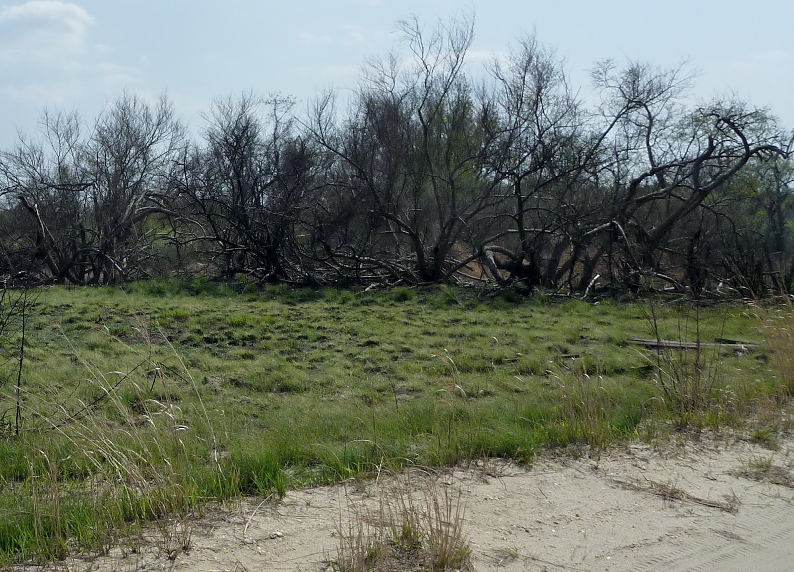
The forest on both sides of the road was scorched for mile after mile as I traveled north. The trunks of the trees – stunted pines as well as the taller deciduous trees -- were completely black. All that was left of some trees were just sticks where the crown should be. Underbrush that had been cleared out by the fire had begun to regenerate, but a passing glance could still penetrate deep into the woods across the top of the young growth. The fire seemed quite recent, perhaps just a few years ago. Although the pines sported branches of green needles, the deciduous trees showed little signs of life.

The site I was checking into was a timber frame house from the late 1700s, located in a clearing along a sandy road in the midst of the Pinelands. Not surprisingly, one of the items to be included in the requested Preservation Plan document was an analysis of the landscaping around the building, “with special attention to the threat of fires.”

Cedar Bridge Tavern (ca. 1780), Barnegat Township, Ocean County, NJ
The Pinelands – once called the “Pine Barrens” – occupies 1.1 million acres of the Pinelands National Reserve, which ranges from northern Ocean County south and west, and occupies 22% of New Jersey's land area. The sands of the Pinelands cover several important aquifers of sweet, clear water, of which the Kirkwood-Cohansey aquifer is the most significant. The sandy soil is the perfect filtration system for rainwater. It captures some 30% of the water that falls to earth, creating an underground storage area that not only feeds all the lakes and streams of the region, but is shallow enough to support all of the plants and trees that sit atop its reservoir. In 1973, the Pinelands Protection Act was passed to protect the pristine water supply and the ecology of this unique natural area from over-development. 

Pond near Cedar Bridge Road, Barnegat Twp, NJ
Fire here is a bizarre counterpoint to that purest, shallowest, and largest of aquifers in the United States.  Wildfires are a natural phenomena in the Pinelands and are integral to its ecology. The sandy soil that filters the waters of the aquifer also soaks up the surface water so efficiently that the leaves and pine needles that drop to the forest floor quickly dry out, leaving the perfect fuel for fires – naturally occurring or man-made. Without the fires that take advantage of the very combustible debris on the forest floor, the deciduous trees would overtake the characteristic pitch pines. If they burn hot enough, the fires kill everything in their path. But oaks, which have thinner bark, are more vulnerable to fire  than the more resilient pitch and shortleaf pines, which need much greater heat to kill their basal cambium layer. Even if their crowns, buds, and branches are burned away, their dormant buds quickly spring to life after a fire.  Fires carry with them benefits for the forest, too. They release the seeds from the pine cones, allowing them to grow unfettered by competition from larger trees. 

Chamaecyparis thyoides (Atlantic White Cypress or Atlantic White cedar)
Innumerable wildfires have swept through the Pinelands over the centuries.  April 1963 is known as one of the worst in recent memory, but just since I established my foothold in South Jersey, I am aware of two major fires that took place in 2002 and 2007. Fire towers throughout the region keep constant vigil. The State of New Jersey, taking a page from the Native Americans who used controlled burns in the Pine Barrens to make it easier to hunt game, creates fire breaks near populated areas and manages controlled burns rather than trying to suppress the fires that naturally occur. However, according to John McPhee in his 1967 book The Pine Barrens, only about 7,000 of the Wharton State Forest’s 96,000 acres are protected by controlled burns each year, due to manpower constraints. 

The fire in early June 2002 was my only experience with a wildfire, albeit indirect. I had just acquired the house in Ocean City. It was the end of another dry spring, like the one we are now experiencing. My son, daughter-in-law, and I had worked all weekend to put the house to rights. We were tired; we left early to avoid the Sunday rush up the Garden State Parkway. Not yet familiar with the rhythms of the summer shore traffic, I was not particularly distressed by the long line of traffic exiting the northbound Parkway lanes at the Atlantic City Expressway. It seemed pretty natural, considering that Philadelphia was a major source of visitors to the shore towns of South Jersey. What we didn’t know was that a wildfire had engulfed some 1,000 acres near Toms River and was burning on both sides of the highway. We continued north.

By the time we reached the Tuckerton exit, it became clear that something other than a normal traffic pattern was taking shape. Our car inched along, covering only a few feet every 15 minutes. At the first available exit, all the cars were diverted off the Parkway onto a road that provided the only means of escape from the conflagration up ahead.  The entire vehicular contents of the Parkway was disgorged onto a small, two-lane road that angles northwest across the wilds of the Pinelands. It had no gas stations, no restaurants, no pull-offs, not many houses, and few signs of civilization. We were on that one road for four hours. I think we only traveled 20 miles, if that. By the time we found a detour that would ultimately take us to the New Jersey Turnpike on the western side of the state, we were starving and in desperate need of rest room facilities. We stopped at the first place we could find – a little hole in the wall with picnic tables and fake palm trees in front that was closing up for the night. We pleaded with the owners to buy something, anything, they had leftover from the day's menu. The owners took pity on us and quickly cooked up some of the best crab cakes I have ever tasted. Such was my first up-close introduction to the Pinelands. 

Stand of scorched trees from an earlier fire in Stafford Forge Wildlife Management Area, NJ
The fire in 2007 that scorched the acres I saw along Route 539 resulted from miscommunication at several levels. A fighter pilot on a low training mission, unaware of the severe fire hazard conditions, dropped a survival flare in the bombing range. It ignited the tinderbox of pine resin and dry leaves, made all the more more flammable by the dry spring. The wildfire affected some 18,000 acres of pine forest, destroyed four homes and damaged thirty-seven more, as well as five boats, three vehicles and four trailers.

Egret in pond near Old Forge Road, Stafford Forge Wildlife Management Area.
When traveling through the volcano and earthquake zone of the northern Cascades two summers ago, I often longed for nature's relative serenity in my home state of New Jersey. Those who live in the Pinelands, however, live in the borderland between peaceful solitude and catastrophe. In this beautiful place, it is only a matter of time before fire will strike again. One would think that this would dissuade all but the heartiest of souls from settling there. 

And yet there, in the middle of the forest, was that wooden house from the late 1700s that, through some quirk of fate, had been spared from the fires that have consumed hundreds – thousands – of acres of wilderness all around it. Our team ultimately decided to pass on this project, but I am hopeful that a successful preservation strategy can be developed for it.  Its survival over more than two hundred years is indeed a remarkable story, here in this land of water and wildfires.
 
Resources

Anderson, Roger Clark, James Steven Fralish, and Jerry Mack Baskin. Savannas, Barrens, and Rock Outcrop Plant Communities of North America. 1999. Rpt. Cambridge UK: Cambridge University Press, 2007. Excerpts courtesy of Google Books: http://books.google.com/books?id=ngZUuCOG0QAC&pg=PA158&dq=anderson,+roger+savannahs&hl=en&sa=X&ei=YwGcT8r_FoSI6AGzp8ylDw&ved=0CDgQ6AEwAA#v=onepage&q=anderson%2C%20roger%20savannahs&f=false accessed April 28, 2012.

“Controlled burns play important role in Pinelands ecology, forest fire prevention.” The Associated Press (February 28, 2012). URL accessed April 28, 2012: http://www.nj.com/news/index.ssf/2012/02/controlled_burns_play_importan.html 

Di Ionno, Mark. “After extremely dry spring, fire in Pine Barrens is inevitable truth.” Star Ledger (April 22, 2012). Online edition. URL accessed April 28, 2012: http://blog.nj.com/njv_mark_diionno/2012/04/di_ionno_after_a_curiously_dry.html 

“Forest fire closes N.J.'s Garden State Parkway.” Pocono Record (June 03, 2002). URL: http://www.poconorecord.com/apps/pbcs.dll/article?AID=/20020603/NEWS/306039994&cid=sitesearch  accessed April 28, 2012). 

Forestry Images. Website. URL: http://www.forestryimages.org accessed April 28, 2012. Forestry Images is a joint project of the Center for Invasive Species and Ecosystem Health, USDA Forest Service and International Society of Arboriculture, The University of Georgia - Warnell School of Forestry and Natural Resources and College of Agricultural and Environmental Sciences.

Forman, Richard T. T. Pine Barrens: Ecosystem and Landscape. 1979. Rpt. Rutgers University Press, 1989. Courtesy Google Books. URL: http://books.google.com/books?id=b-scntoSJ7QC&dq=pine+barrens+forest+fire+pitch+pine+serotinous+pine+cone&source=gbs_navlinks_s accessed April 28, 2012. 

Little, Silas. “Fire Effects in New Jersey's Pine Barrens.” Frontiers (Winter 1978).  Reprinted with permission granted from the Academy of Natural Sciences of Philadelphia in Pinelands Guide, Burlington County Library System website. URL: http://www.bcls.lib.nj.us/pinelands/fire.shtml  accessed April 28, 2012.

McPhee, John. The Pine Barrens. New York: Farrar, Straus and Giroux, 1967, 1968.

Moore, Kirk and Nicholas Huba. “Fire breaks are set up in N.J. Pinelands to help battle blazes.” Asbury Park Press. Courtesy of Star-Ledger Wire Services (May 18, 2011).  URL accessed April 30, 2012: http://blog.nj.com/ledgerupdates_impact/print.html?entry=/2011/05/fire_breaks_are_set_up_in_pine.html. 

“1,000-acre fire closes Garden State Parkway N.J. blaze engulfs 1 house, threatens hundreds more.” Baltimore Sun (June 03, 2002), by New York Times News Service. http://articles.baltimoresun.com/2002-06-03/news/0206030204_1_garden-state-parkway-toms-river-jersey-shore  
 

Peterson, Iver. "Fire in the Pine Barrens: Keeping the Oak at Bay.” The New York Times (May 29, 1992). URL http://www.nytimes.com/1992/05/29/nyregion/fire-in-the-pine-barrens-keeping-the-oak-at-bay.html, accessed April 28, 2012.

Pinelands Preservation Alliance. Website. URL: http://www.pinelandsalliance.org/  
 

Pineypower: General Information about the Pinelands. Website: URL accessed April 30, 2012: http://www.pineypower.com/geninfopbpg10.html 

Stansfield, Charles A. A Geography of New Jersey: the City in the Garden. 1988. Rpt. 2004, Rutgers University Press. Courtesy of Google Books. URL accessed April 28, 2012: http://books.google.com/books?id=FTXwgHg89W8C&printsec=frontcover&dq=geography+of+new+jersey&hl=en&sa=X&ei=bv-bT8rCEYe16AHF9ez8Dg&ved=0CDsQ6AEwAA#v=onepage&q=geography%20of%20new%20jersey&f=false.

TheArgus [Tuckerton, NJ]. “May 15 New Jersey Pinelands Fire Blamed on Pilot Error.” Now Public: CrowdPowered Media (July 30, 2007). URL accessed April 30, 2012: http://www.nowpublic.com/may_15_new_jersey_pinelands_fire_blamed_pilot_error

.

Saturday, March 31, 2012

Change and Permanence in Washington DC

View of the White House from Lafayette Square, March 2012.
Arrival

It could have been scene from the film Grand Hotel, except that blue denim, not fur, was the most common fashion statement. The lobby was bustling with activity. Duffel bags, suitcases, rugs, lamps, books – all the items that typically populate a college student’s room – stood in great piles at the elevator doors, awaiting their trip to the upper floors. I waved goodbye to my parents at the curb and returned to the lobby. Smiling vacantly at no one in particular, I surveyed the confusion. “What have I done?” I mumbled. I felt lost.

Thurston Hall, 1964. Courtesy of Special Collections Research Center, Melvin Gelman Library, The George Washington University.

At eight stories, Mable Thurston Hall was known to many as the “Superdorm” of George Washington University. I came to GWU for my junior year, having transferred from a small women’s college in upstate New York. Thurston was the dorm to which all women transfer students were assigned. Our fellow residents were students of the upper classes who had opted to remain on campus for the duration. All told, there were over 1,600 teen-aged women housed in that dorm, more than the total number of students in my hometown high school. Its well-earned nickname was “The Zoo.”

I didn’t stay in Thurston long. The following semester, my two roommates and I left the Zoo for a one-bedroom apartment in a nondescript but functional apartment building near 17th and P Streets, N.W. We had to walk the mile or so to Foggy Bottom each day for classes, but it was a real neighborhood. It had a grocery store, a cheap restaurant, and its share of eccentric locals. It was preferable to living downtown where, just beyond the boundaries of the campus, the city consisted of little else but block-long, concrete buildings filled with government offices.

Revolution

I arrived in Washington in 1968, on the heels of the anti-war demonstrations at Democratic National Convention in Chicago. It was during the last few months of President Lyndon Baines Johnson’s term of office and the end of the Great Society. The city was populated by thousands of earnest bureaucrats and dedicated civic activists who either served in or were served by these new programs. Although it may have made for good public policy, the city was not very exciting for a 20-something college student.

In January 1969, Richard Nixon became President. Overnight, the workers of the Great Society seemed to go underground. An administration of a very different flavor had taken their place. The city became more subdued, internal – perhaps reflecting the introverted nature of Nixon himself. There was no exuberance, no glamour, no artful eccentricities anywhere, that I could see. Everyone was government, guarded.

Ten months after Nixon’s swearing-in, I saw Washington radically transformed in a very different direction. The Moratorium against the War, which began on November 15, 1969, was one of the first successful mass demonstrations against the Vietnam War. Some 500,000 demonstrators converged on DC for protest marches and other actions. Beards and long hair were everywhere, temporarily displacing the short, military haircuts of the reigning Republicans. Tear gas wafted through the crowds at Dupont Circle, which, until then, was a quiet neighborhood of students and political activists. The Moratorium, and the May Day demonstrations of 1971 that followed it, filled the city with students, Boone's Farm Apple wine, and copious bowls of brown rice and vegetables. After that, the town was never the same for us.

In 1972, J. Edgar Hoover died and Nixon won his second term of office. I stayed in DC until January 1973. I followed my future husband to New Jersey after his graduation from law school, just as the Vietnam War was ending and the Watergate scandal was reaching a fever pitch around Nixon's head. I returned to Washington rarely after that. Things were too busy to be thoughtful about it when I did, what with young sons to raise, graduate studies, and finally my return to work.

Evolution

I recently attended a workshop in the Old Post Office Building, located in the Federal Triangle on the other side of the White House from the campus of GWU. The trip gave me the opportunity to update the memories of my old haunts.

Main Entrance, Old Post Office Building
Washington never looked more beautiful. The cherry blossoms and tulips were in full bloom. Although it was cool and drizzly, it was the embodiment of the delightful spring days for which DC is known. That day's lead news story was a film clip of Secret Service agents at the White House helping baby ducklings through the wrought iron fence to reunite them with their mother. http://www.nbcwashington.com/news/local/Family-of-Ducks-Visits-White-House-143726946.html#

I was struck by how the Federal Triangle had changed since I last saw it. This should not have been surprising; 40 years had passed, after all. Hubris had tricked my subconscious into believing that DC would always remain the city I knew when I was 25.

View from the clock tower of the Old Post Office Building. Ronald Reagan building at lower left; Treasury Department and White House at center; Freedom Plaza at lower right.
When I left the city, I remember the Federal Triangle as being rather bleak. It was a mere tangent on the outer edge of my usual sphere of activity. I was a law student, caught up in swirling life of politics and culture - the city fabric was interesting, but somehow irrelevant to the critical issues of the day as I saw them. Now, after decades immersed in art, architecture, and history, I found my vision of the city had grown less myopic, less ephemeral. No longer focused exclusively at DC's chameleon-like political persona, it now included the buildings that play such an important role in the zeitgeist of that city.

In October 1972, anticipating the impending Bicentennial celebrations and an influx of millions of tourists, Congress formed the Pennsylvania Avenue Development Corporation to help redevelop and improve the Federal Triangle. Substantial investment has since been poured into the area. A number of talented architects have added of good designs to the streetscape. It is no longer the dismal passage from the Capitol Building to the White House I remember from the 1960s. Instead, there are buildings imbued with “New Classicism,” like the Ronald Reagan Building (1990-1998; Pei Cobb Freed & Partners, Archs.). This enormous building, second in size only to the Pentagon, disguises its immensity behind a colonnaded corner and domed rotunda. It is well-proportioned to the street and the surrounding buildings. It sits in reasonable harmony with the Beaux Arts District Building (1904-1908; Cope and Stewardson, Archs.) at 14th Street and the Avenue, now called the James A. Wilson Building, where caryatids still keep their vigil along the cornice.

The John A. Wilson Building (formerly the District Building)
Two historic hotels also thrive in this area, adding style and patina. The venerable Washington Hotel (1917-1918; Carrère and Hastings) at the corner of 15th Street across from the Treasury Department has been fully renovated and reopened as a “W Hotel.” At the corner where an elegant patio restaurant with red umbrellas is now installed, I was crushed breathless in the clutch of humanity that lined the sidewalk watching Richard Nixon's inaugural parade.

"W" Hotel - Washington DC, 15th and Pennsylvania Avenue.
At the corner of 14th Street and the Avenue, stands the Willard (1904; Henry Janeway Hardenbergh, Arch.), which many call Washington's first skyscraper; some 100 rooms were added to it in 1925. Limousines are parked in front of the Willard these days, in what in the 1970s would have been an unheard-of display of affluence.  I doubt that I would have even been allowed up the front stairs during the days of the Cultural Revolution.

Entrance to the Willard on Pennsylvania Avenue
Just a block away from the panache of the Willard and the W hotels, the forces of "Occupy Washington, DC" have pitched their tents and posted their placards at Freedom Plaza, formerly Western Plaza (1981; Venturi, Rauch and Scott Brown, Archs.). This is one of two "Occupy" locations I saw downtown during my brief stay, the other being in the park where, tired and hungry after a long day demonstrating, my friends and I stopped to rest our feet and enjoy a late afternoon picnic of wine and cheese. (Let it never be said that during the Revolution I lost perspective as to what was really important.)

"Occupy DC" encampment, Freedom Plaza.
The Old Post Office Building (1892 – 1899; Willoughby J. Edbrook, Arch.) remains a prominent landmark on the Pennsylvania Avenue. The original 1972 redevelopment plans threatened to demolish it, leaving only the tower. Fortunately, the plans were overcome by preservation advocates, led by Nancy Hanks, then Chair of the National Endowment for the Arts. Today it houses the Advisory Council on Historic Preservation, National Endowment for the Arts, the National Endowment for the Humanities, a spectacular interior court, food vendors, and several souvenir shops. The building also offers breathtaking 360-degree views of the city from the top of the old tower. 

Old Post Office Building, Pa. Ave. & 12th Street
One of the Old Post Office Building’s greatest distinctions, however, is as home to the Congress Bells. The Bells were presented to the United States in 1976 by the private Ditchley Foundation of Great Britain in honor of the Bicentennial and installed in the Old Post Office tower in 1983, on its re-dedication. The bells, replicas of the bells of Westminster Abbey, are tended by the Washington Ringing Society of the North American Guild of Change Ringers. They peal in honor of the opening and closing of Congress and on state occasions, including all national holidays.

One of the Congress Bells, Old Post Office Building
Recently, it was announced that the GSA has awarded Donald Trump, the New York real estate developer, and Colony Capitol, the right to develop the Old Post Office Building as a luxury hotel, something that has caused its share of consternation among the denizens of DC. According to the Huffington Post, Trump envisions “top-level restaurants spilling out into the sidewalk, a spa and hotel with 260 suites and penthouses that are ‘designed to be the most luxurious in the city.’”

Interior light court, Old Post Office Building
It will involve a projected investment of some $200 Million. Trump will also have to submit the project for review to a long list of commissions, organizations and governmental entities, including the National Capital Planning Commission, the U.S. Commission of Fine Arts, the D.C. Historic Preservation Office, the Advisory Council on Historic Preservation, the National Park Service, and the General Services Administration.

Complexity and Contradiction

Washington is our national stage, where all the complex, interwoven plots and subplots of our narrative unfold. Far from the staid, white city I knew, Washington today is a vibrant metropolis with its share of Starbucks and young, political idealists bearing messenger bags and IPods. It has a confidence and urbanity that perhaps reflects the personality of the current administration.

The challenging economic times facing us, however, may ultimately leave DC a sadder, poorer capitol city. Already hovering at the edge of the political core and just few steps from the Willard, placards of "Occupy DC" call for the end of the spectre of corporate greed. A few blocks away at Lafayette Square, banners spelling out "J-O-B-S" march across the colonnaded facade of the building that houses the conservative U.S. Chamber of Commerce, facing the general direction of the White House. These signs evidence two facets of the same Recession - albeit from opposite sides of the political divide.

Chamber of Commerce Building (1922-1925; Cass Gilbert, Arch.), 16th & H Sts
Washington is ever thus: a stage set for actors in national drama. Here, antithetical forces vying for influence duel against the backdrop of DC's buildings and neighborhoods. It was comforting to see that, even after my long absence (over nine administrations), most of the grand buildings once so familiar to me are still beautiful and continue to serve, even if their uses may have changed over time. Worthy new buildings and parks have added their voices to the architectural conversation.

I hope it doesn't take another 40 years to get me back to this remarkable city. I figure I'll have to come back at least to check on the Donald's new hotel. I've already picked out my room.

Resources:

"Family of Ducks Visits the White House." NBC Washington. URL accessed 2 October 2012: http://www.nbcwashington.com/news/local/Family-of-Ducks-Visits-White-House-143726946.html#>

DePillis, Lydia “Housing Complex -Going Postal: Donald Trump wants to turn D.C.'s Old Post Office into a viable enterprise.” Washington City Paper. URL accessed 31 March 2012: http://www.washingtoncitypaper.com/blogs/housingcomplex/2011/08/11/going-postal/ . Posted Aug. 11, 2011, 7:24 am.

“Donald Trump: Old Post Office Building Project Will Bring Greatness.” The Huffington Post. Website. URL accessed 31 March 2012:

Ganschinietz, Suzanne, Arch. Historian, National Capitol Planning Commission. “Federal Triangle.” Nomination to the National Register of Historic Places (June 19, 1973).

Pearlstein, Steven. “What D.C. doesn’t need: a Trump Tower.” Washington Post.. Internet edition. URL accessed 31 March 2012:  http://www.washingtonpost.com/what-dc-doesnt-need-a-trump-tower/2012/02/06/gIQAROBP7Q_story.html (Posted 11 February 2012).

“Pennsylvania Avenue National Historic Site.” Washington, DC: A National Register of Historic Places Travel Itinerary. Website maintained by the National Park Service. URL accessed 31 March 2012: http://www.nps.gov/nr/travel/wash/dc41.htm 

Special Collections Research Center, The Melvin Gelman Library, The George Washington University. “Thurston Hall.” The George Washington University and Foggy Bottom Historical Encyclopedia. Website. URL accessed 31 March, 2012: http://encyclopedia.gwu.edu/gwencyclopedia/index.php?title=Thurston_Hall

 “The Willard.” Washington, DC: A National Register of Historic Places Travel Itinerary. National Park Service website. URL accessed 31 March 2012: http://www.nps.gov/nr/travel/wash/dc36.htm

.